|
|
|
NDVI
datasets for Central Europe
|
|
_____________________________________________________________
|
|
|
Description:
|
| The
MODIS-adjusted NDVI3g dataset was created from the original
NDVI3g (Pinzon and Tucker, 2014) to support vegetation
related research in Central Europe. Details about the method
used for the creation of this dataset are available in Kern
et al. (2016). |
|
| References: |
|
- Kern, A., Marjanovic, H., Barcza, Z., 2016. Evaluation of
the Quality of NDVI3g Dataset against Collection 6 MODIS NDVI
in Central Europe between 2000 and 2013. Remote Sensing,
8(11) 955, doi:10.3390/rs8110955
|
| -
Pinzon, J.E.; Tucker, C.J., 2014. A Non-Stationary 1981-2012
AVHRR NDVI3g Time Series. Remote Sensing 6, 6929-6960.
doi:10.3390/rs6086929 |
|
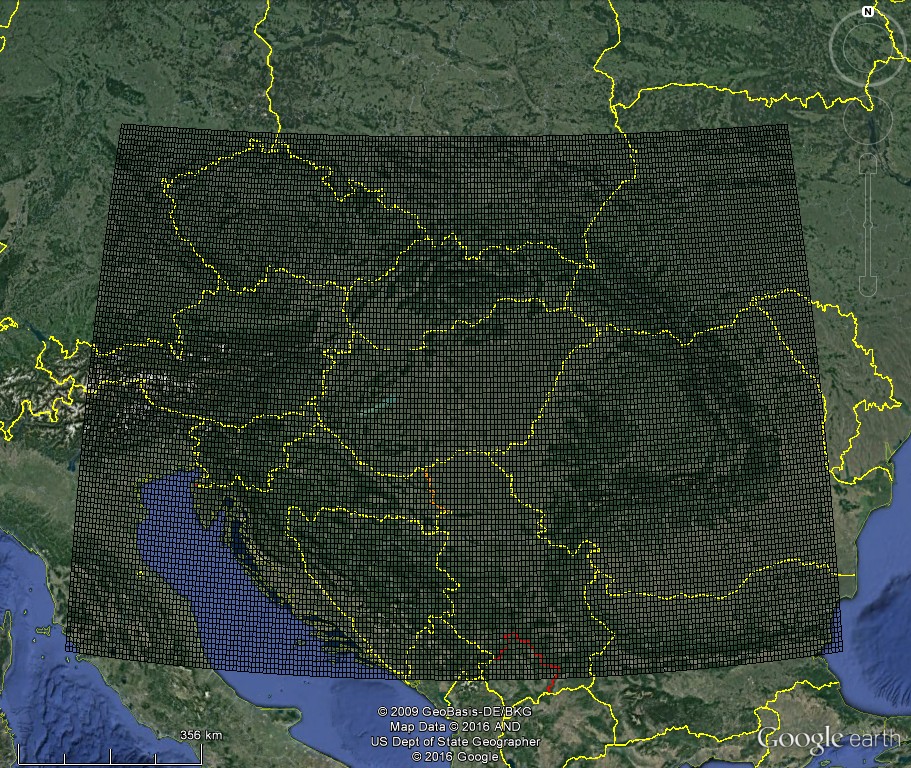
| Resolution
and coverage: |
| The
dataset has an 1/12° × 1/12° spatial resolution
covering Central Europe (42.5833-51.0833°N and 10.9167-28.0833°E)
with a 15-day temporal resolution. |
|
| Datasets
(in the format of NetCDF): |
| MODIS-Adjusted
NDVI3g - (1982-2013) |
|
The
datasets contains the values of the MODIS-adjusted NDVI3g
and the needed longitude and latitude information: Terra.C006.MODIS_Adjusted_NDVI3g_CE_1982-2013_v3.1.max.nc
(available also at Zenodo)
Aqua.C006.MODIS_Adjusted_NDVI3g_CE_1982-2013_v3.1.max.nc
|
|
| C6
Terra/MODIS NDVI
- (2000-2013) |
|
The
dataset contains the values of the 1km C6 Terra/MODIS NDVI
(MOD13A2, provided by NASA) resampled to the 1/12° ×
1/12° grid of NDVI3g and also the needed longitude and
latitude information:
Terra.MODIS.C006_NDVI_CE_2000-2013_v3.1.max.nc
|
|
| C6
Aqua/MODIS NDVI
- (2003-2013) |
The
dataset contains the values of the 1km C6 Aqua/MODIS NDVI (MYD13A2,
provided by NASA) resampled to the 1/12° × 1/12°
grid of NDVI3g and also the needed longitude and latitude information:
Aqua.MODIS.C006_NDVI_CE_2003-2013_v3.1.max.nc
|
|
GoogleEarth©
image
KLM
file to see the gridcells of the
Central European domain
|
| Created
by: dr.
Anikó KERN, dr.
Hrvoje MARJANOVIC and dr.
Zoltán BARCZA |
| |
|
|