 |
Remote
sensing releated research at the
Eötvös Loránd University based on data provided by the ELTE receiving station |
 |
||||
|
DBCRAS
|
||||||
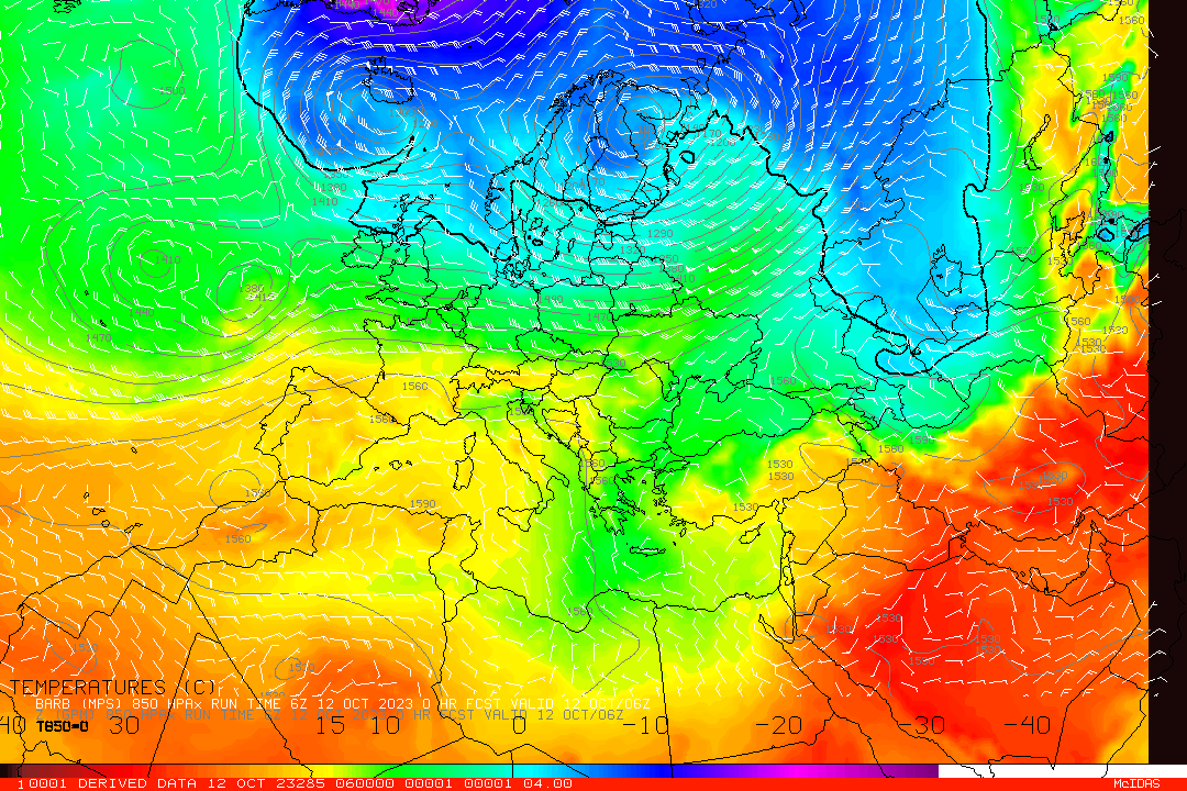
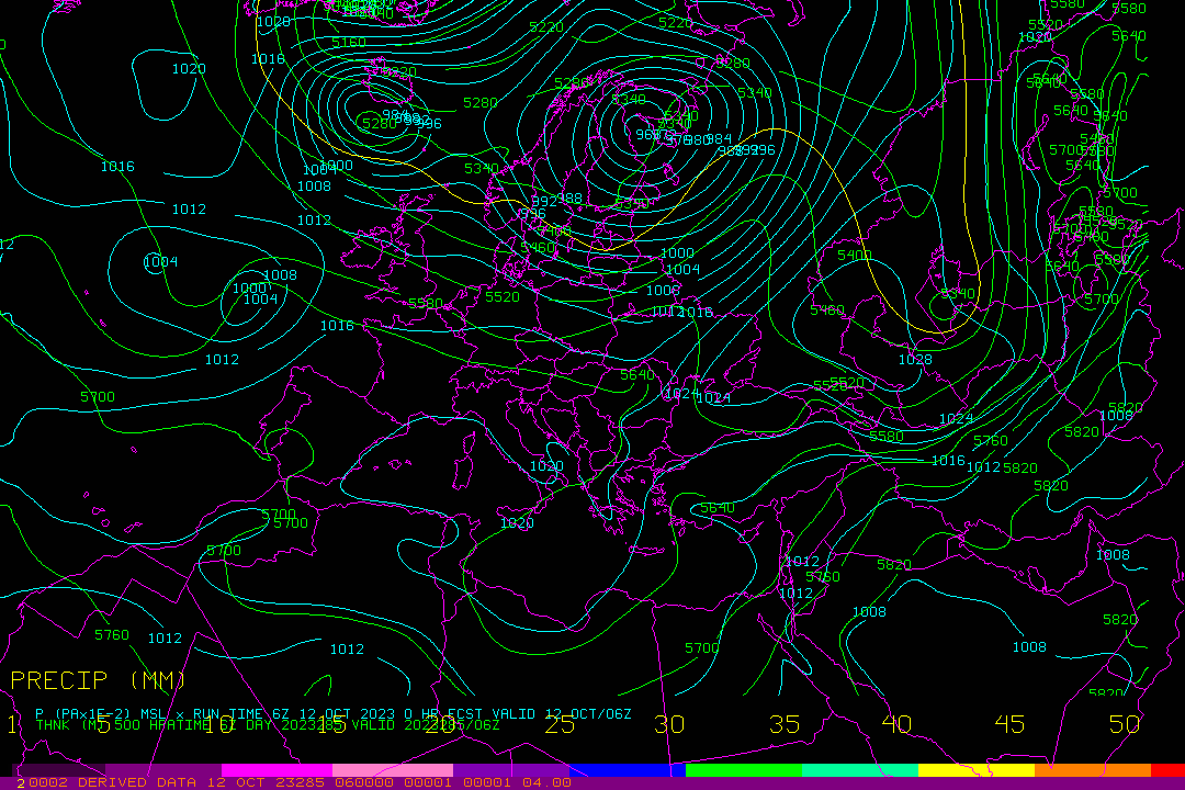
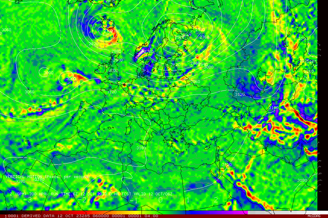
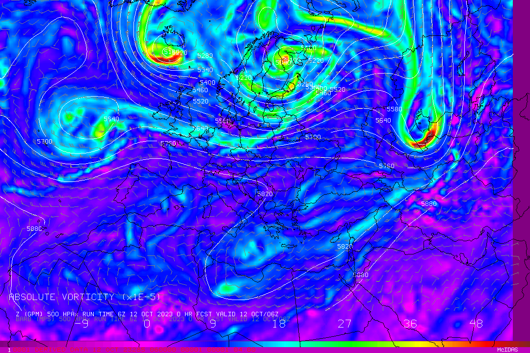
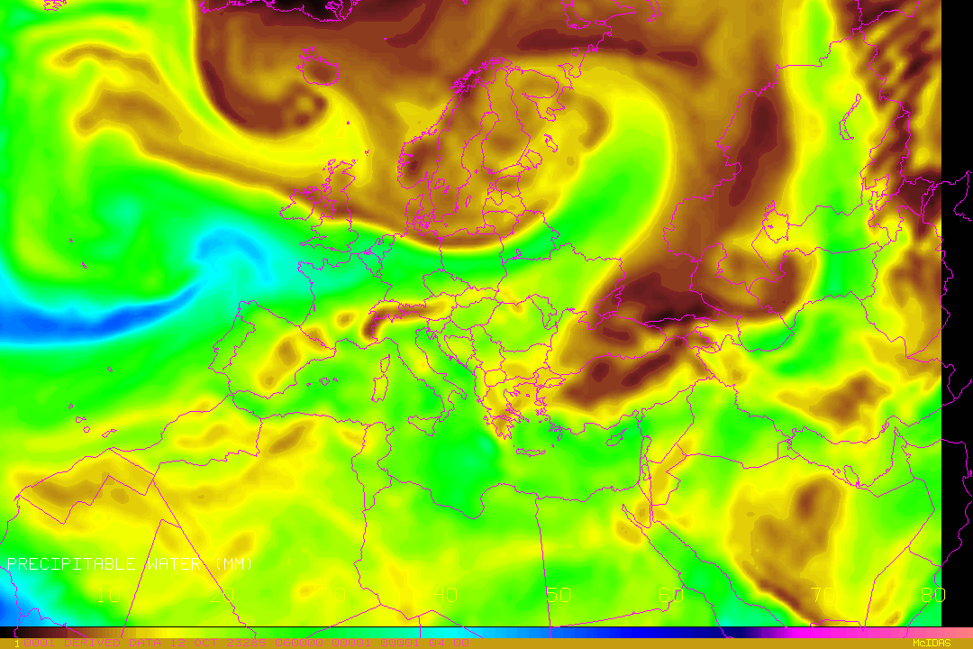
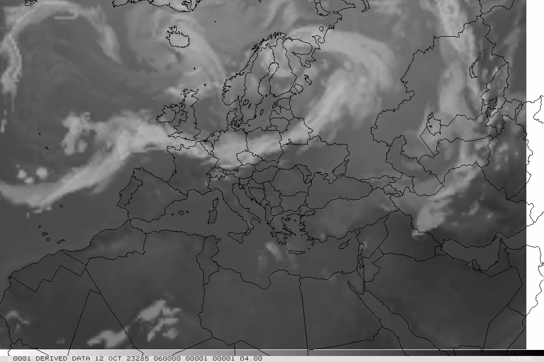
Weather
forecast based on a numerical weather prediction model
assimilating Direct Broadcast MODIS data
- The model is experimental -
|
DBCRAS
output loops (for
72 hours, with 3 hours time steps, initiated daily at 00 and 12
UTC)
|
|
| Meteogram for Budapest (47.5°N, 19°E) | |
 |
 |
|
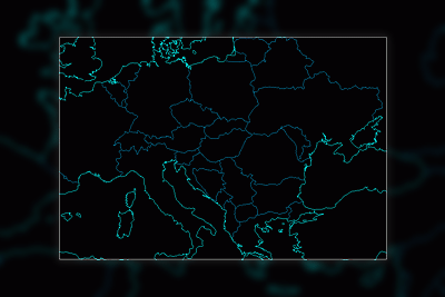
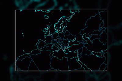
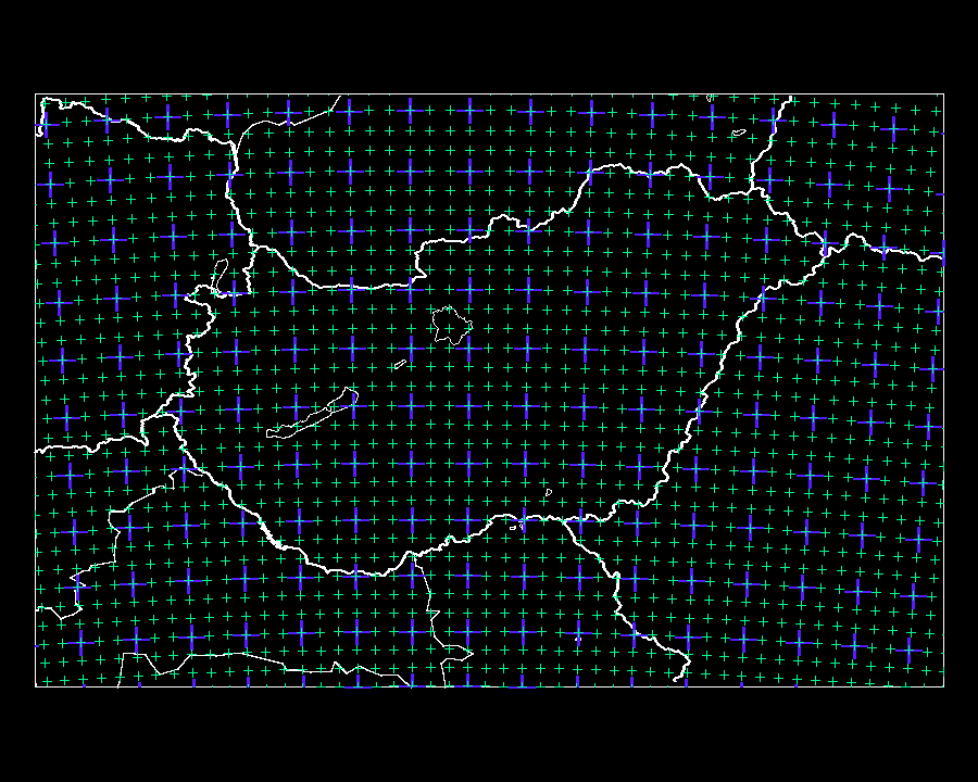
Domain
of NDBCRAS
|
Domain
of DBCRAS
|
DBCRAS:
Direct Broadcast CIMSS Regional Assimilation System (2008)
NDBCRAS: Nested DBCRAS (2009)
Created by: Bob Aune, Kathy Strabala, Scott Lindstrom,
Allen Huang (CIMSS, University
of Wisconsin Madison)
Hungarian adaptation: Anikó Kern,
Zoltán Barcza
(ELU, Department of Meteorology)
|
DBCRAS |
|
The
gridpoints of DBCRAS and NDBCRAS located in the region of Hungary
can be seen here |
|
|
| Back |
05.06.2018.
|
|
The
website was designed and it is maintained by: Kern
Anikó
Copyright (C) ELTE |