 |
Remote
sensing releated research at the
Eötvös Loránd University based on data provided by the ELTE receiving station |
 |
||||
|
MODIS
data
|
||||||
|
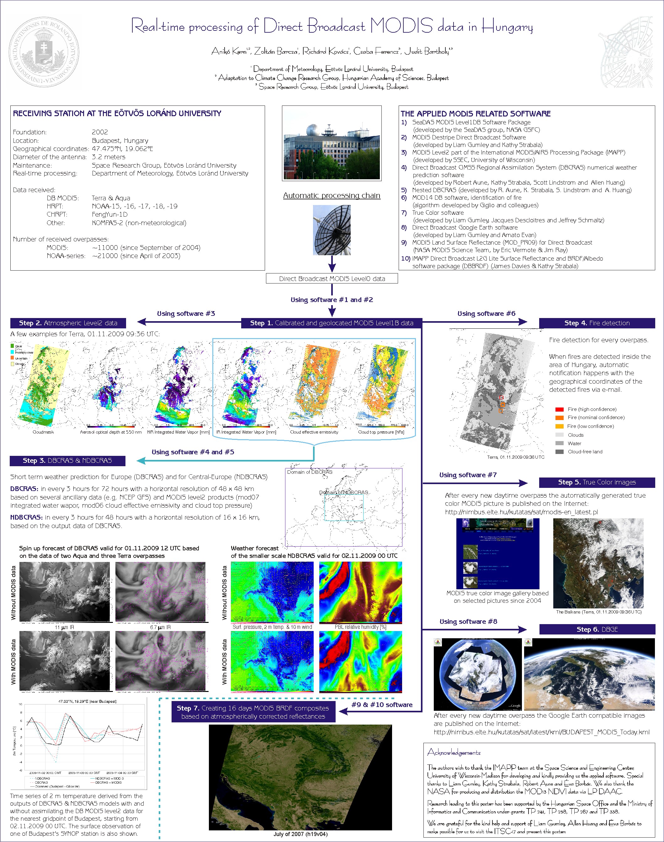
The received Direct Broadcast (DB) MODIS data are automatically processed based on freely distributed software packages. The chain with examples is shown on the following poster.
As the first step, after every Terra/Aqua overpass our processing chain begins with creating geolocated and calibrated radiances from the raw data stream using the MODIS Level1DB software of the SeaDAS group. The preprocessed data of the infrared bands are then destriped removing artificial stripes. In order to retrieve atmospheric properties from these Level 1B data we use the MODIS Level2 part of the International MODIS/AIRS Processing Package (IMAPP). These atmospheric, near-real time Level2 products are assimilated twice a day (at 00 and 12 UTC) by the Direct Broadcast CIMSS Regional Assimilation System (DBCRAS) numerical weather prediction software and by its nested version (NDBCRAS). The DBCRAS and NDBCRAS models calculate 72 and 48 hours long weather forecasts with 48 and 16 km horizontal resolution, respectively. Based on the infrared information of the MODIS data the fire pixels are identified (for clear regions) with the utilization of the MOD14 DB software. During daytime two additional software is also included in the processing chain. The first is the True Color software generating high resolution images for every overpass. The second is the Direct Broadcast Google Earth (DBGE) which converts the true color imagery to a compatible format with the popular Google Earth software. The link for the daily MODIS imagery covering whole Europe can be found at http://nimbus.elte.hu/kutatas/sat/modis-en_latest.pl. |
| Back |
The website was designed and it is maintained by: Kern Anikó
Copyright (C) ELTE Department of Meteorology