 |
Remote
sensing releated research at the
Eötvös Loránd University based on data provided by the ELTE receiving station |
 |
||||
|
MODIS
images
|
||||||
|
2016
|
Selection of the received Terra/Aqua True Color MODIS images from 2016
 |
Low level stratus clouds in the Carpathian-Basin: 2 hours later after the overpass of satellite Terra (see below) (Aqua, 2016.12.09. 12:06) |
 |
Low level stratus clouds in the Carpathian-Basin (Terra, 2016.12.09. 10:07) |
 |
Low level stratus clouds in Central Europe (Terra, 2016.12.06. 09:36) |
 |
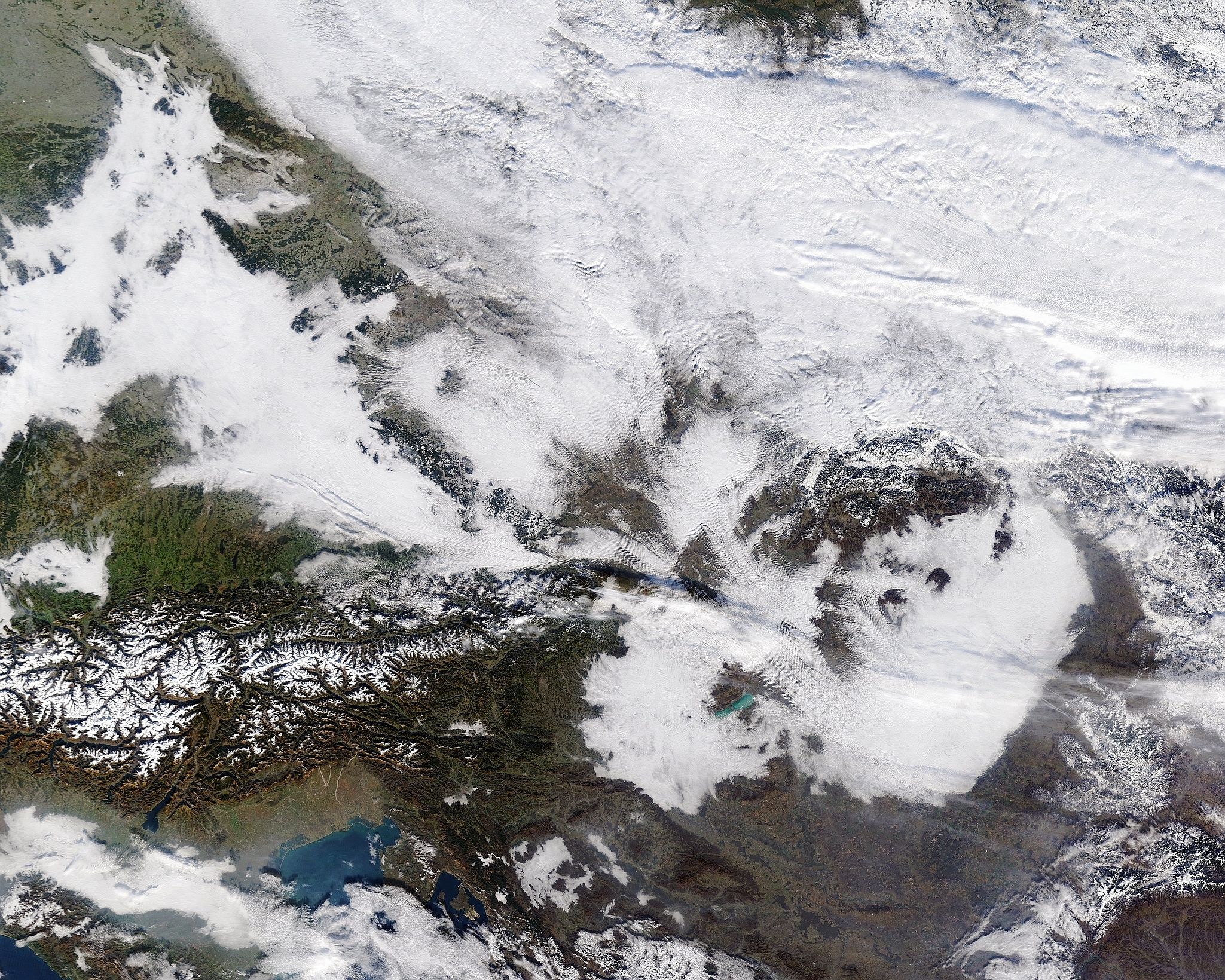
Snow in the Northern Carpathians (Aqua, 2016.12.04. 11:48) |
 |
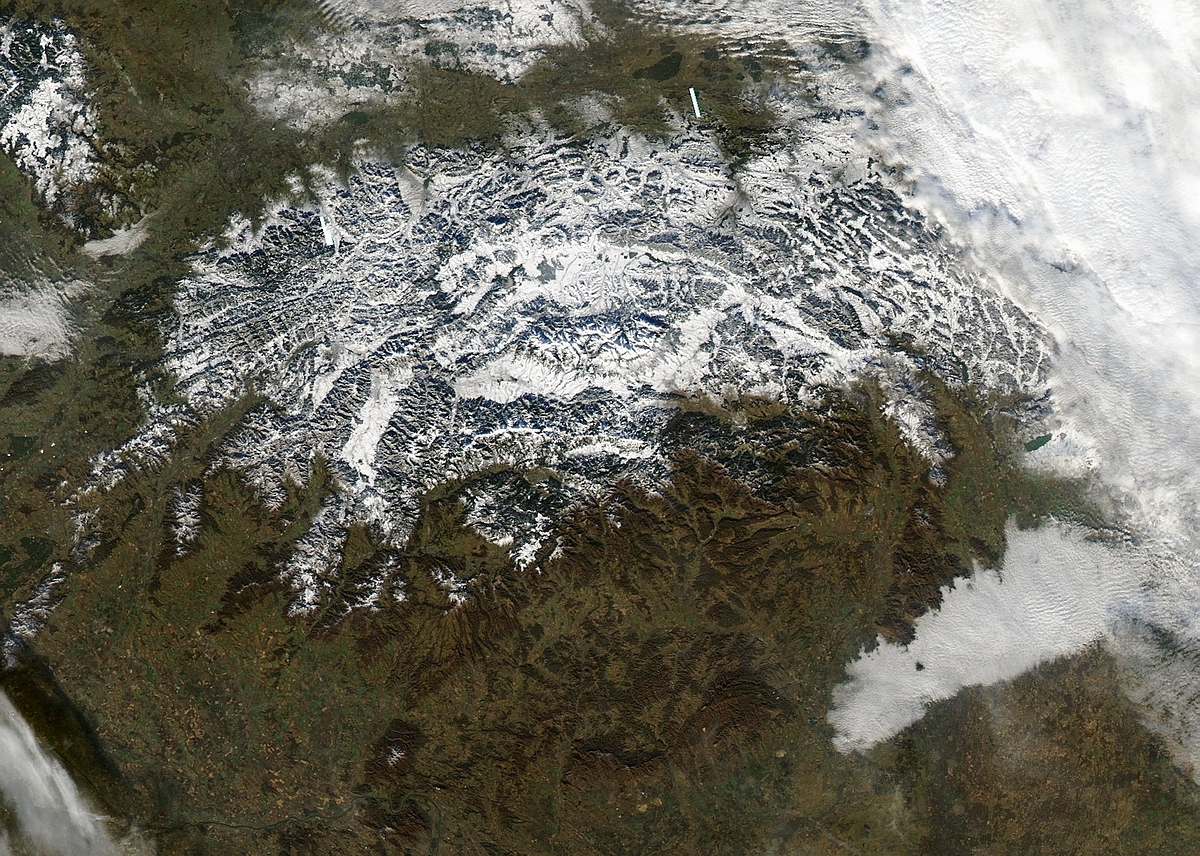
The clear Alps (Terra, 2016.11.30. 10:13) |
 |
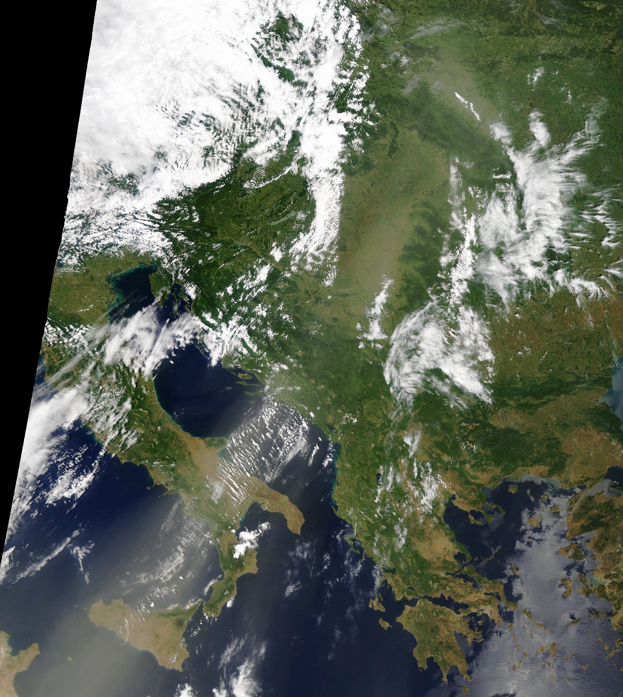
Low level stratus clouds to the East and South from the Carpatians due to anticyclonic weather situation over southeastern Europe (Terra, 2016.11.21. 08:41) |
 |
Clear weather in Hungary (Aqua, 2016.10.22. 12:06) |
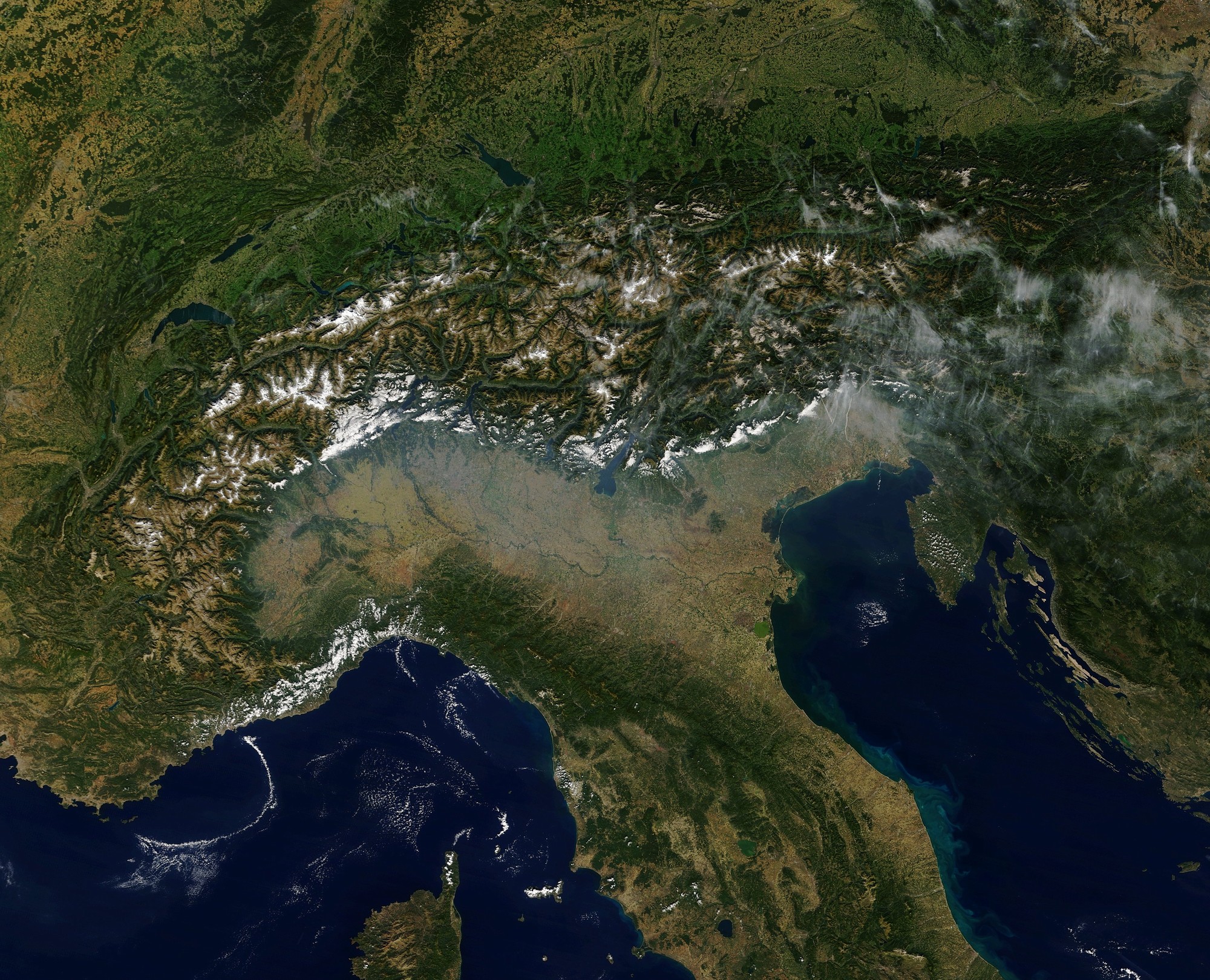 |
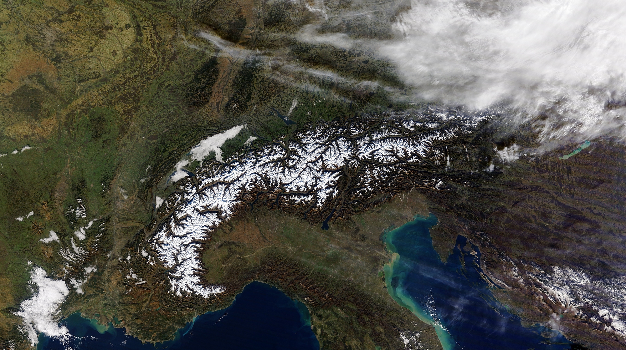
The Alps, and the Po valley with polluted air (Terra, 2016.09.29. 10:17) |
 |
Saharan dust stream towards Central Europe (Terra, 2016.06.17. 09:13) |
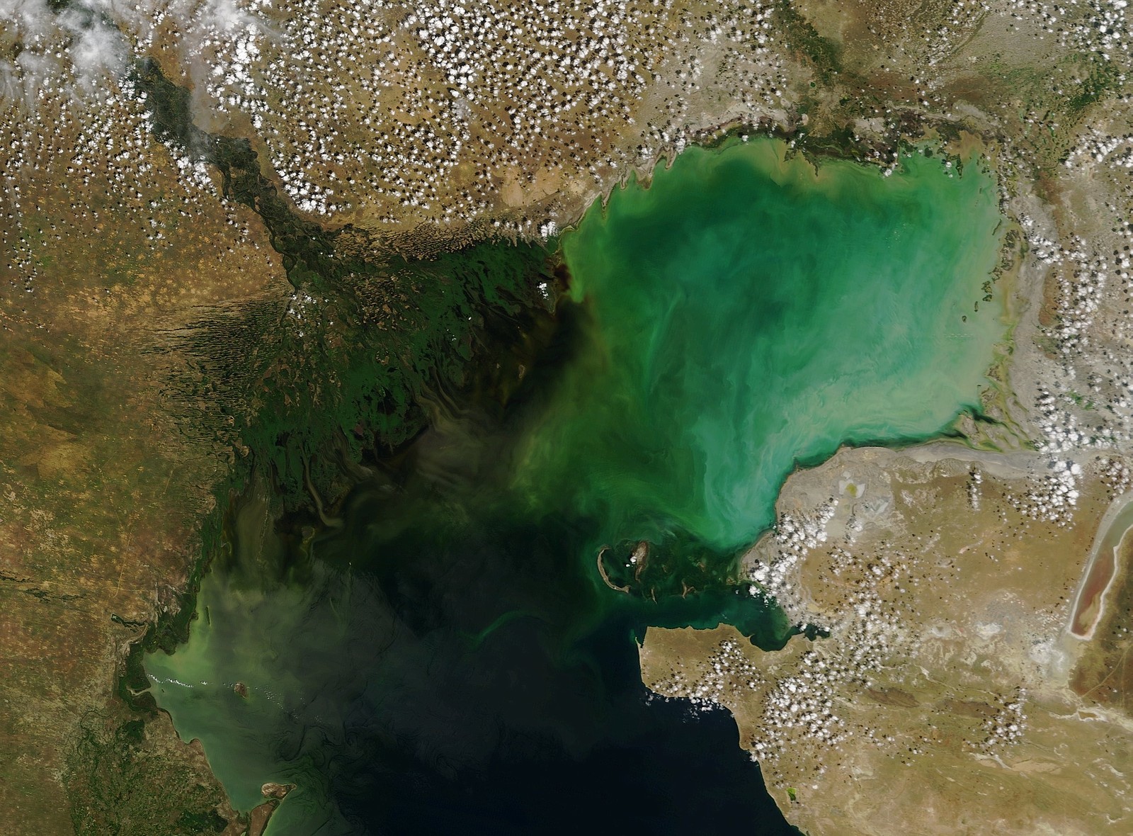 |
Delta of river Volga and the northern basin of the Caspean Sea (Terra, 2016.06.13 08:00) |
 |
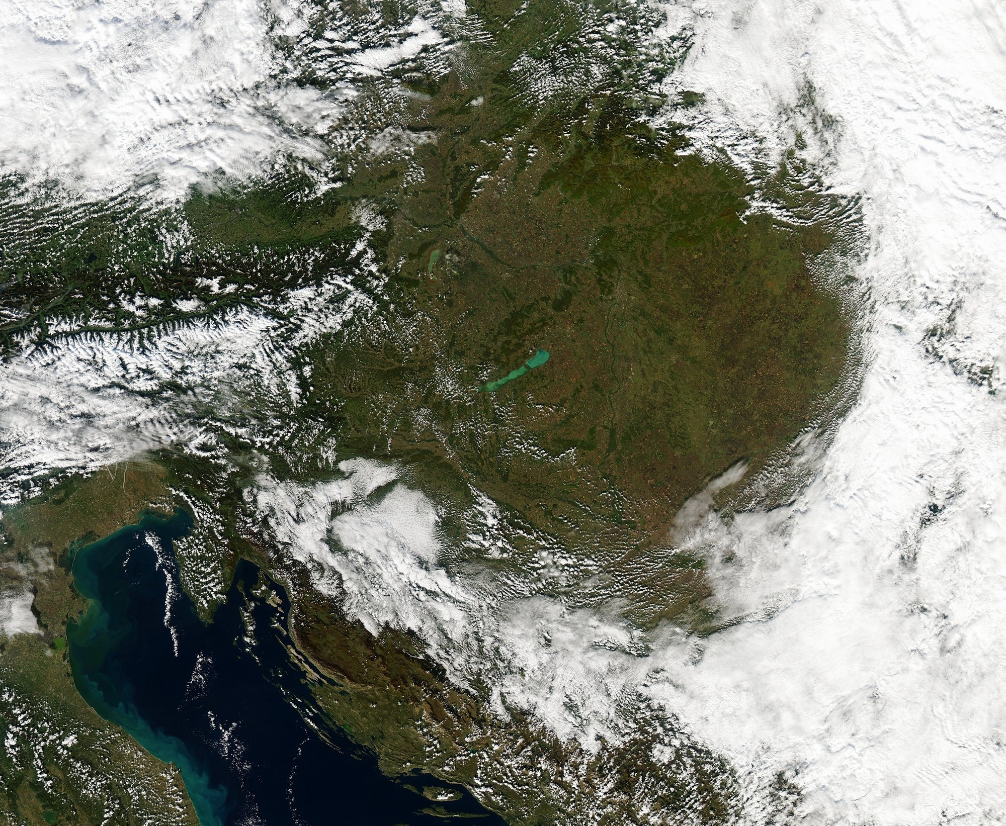
Storm cloud over Lake Balaton (Aqua, 2016.06.06. 11:30) |
 |
Saharan dust over the Mediterranean Sea (Aqua, 2016.05.20. 12:26) |
The
applied software is the MODIS True Color which was created by Liam
Gumley (1),
Jacques Descloitres (2) and Jeffrey Schmaltz (2), 2003.
(1) Space Science and Engineering Center, University of Wisconsin-Madison
(2) MODIS Rapid Response Team, NASA Goddard Space Flight Center
The
installation of the satellite data receiving station was supported by
the Hungarian Space Office and The Ministry
of Informatics and Communication
|
The
number of visitors since Februar 15, 2005:
|
|
| Back |
21.04.2018
|
The website was designed and it is maintained by: Kern Anikó
Copyright (C) ELTE